My Genealogy Hound
Phillips County, Arkansas 1889 Map
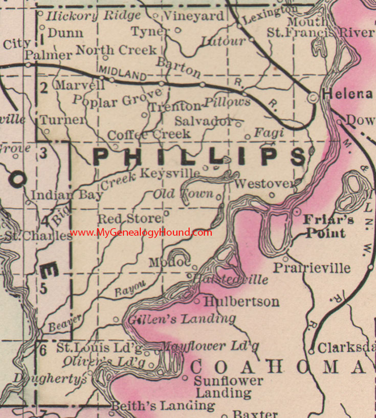
Locations shown include: Barton, Coffee Creek, Doughertys, Dunn, Fagi, Gillen's Landing, Halstedville, Helena, Hickory Ridge, Keysville, Lexington, Lutour, Marvell, Midland, Modoc, North Creek, Old Town, Oliver's Landing, Pillows, Poplar Grove, Red Store, St. Louis Landing, Salvadore, Trenton, Turner, Tyner, Vineyard, Westover
This is a portion of a Arkansas map published by Bradley, circa 1889.
View family biographies from the 1890 History of Phillips County: Phillips County, Arkansas
View additional Arkansas Maps here: Arkansas County Maps
County maps from other states can be viewed here: State County Maps
Additional Phillips County resources: Phillips County, Arkansas History, Genealogy, and Maps
Use the links at the top right of this page to search or browse thousands of family biographies.