My Genealogy Hound
Rutherford County, Tennessee 1888 Map
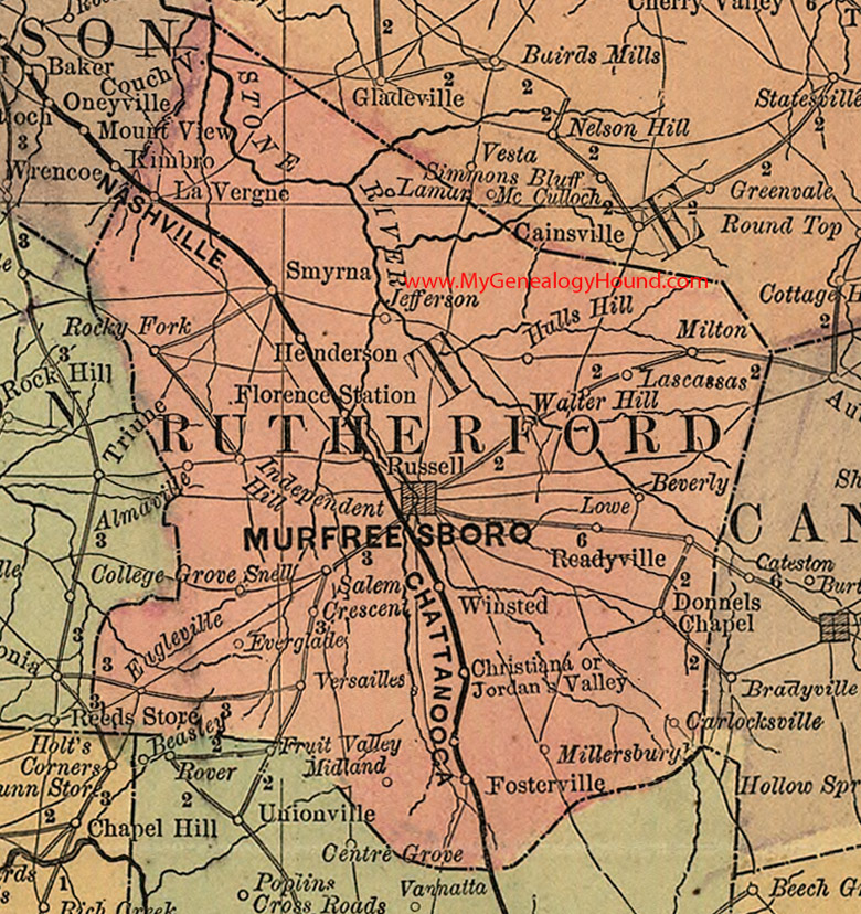
Locations shown include: Almaville, Beverly, Carlocksville, Christiana, Crescent, Donnels Chapel, Eagleville, Everglades, Florence Station, Fosterville, Henderson, Hulls Hill, Independent Hill, Jefferson, Jordan's Valley, Lamar, Lascassas, La Vergne, Lowe, Midland, Millersburg, Milton, Murfreesboro, Rocky Fork, Russell, Salem, Smyrna, Snell, Versailles, Walter Hill, Winsted
This a portion of a Tennessee map by Rand, McNally & Co. 1882, 1888
View additional Tennessee Maps here: Tennessee County Maps
County maps from other states can be viewed here: State County Maps
Use the links at the top right of this page to search or browse thousands of family biographies.