My Genealogy Hound
Putnam County, Tennessee 1888 Map
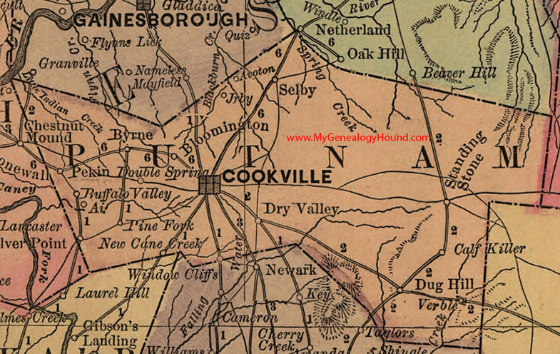
Locations shown include: Ai, Avoton, Bloomington, Buffalo Valley, Byrne, Calf Killer, Cookeville (Cookville), Double Springs, Dry Valley, Dug Hill, Jrby, New Cane Creek, Pekin, Pine Fork, Selby, Standing Stone, Verble, Window Cliffs
This a portion of a Tennessee map by Rand, McNally & Co. 1882, 1888
View additional Tennessee Maps here: Tennessee County Maps
County maps from other states can be viewed here: State County Maps
Use the links at the top right of this page to search or browse thousands of family biographies.