My Genealogy Hound
Morgan County, Tennessee 1888 Map
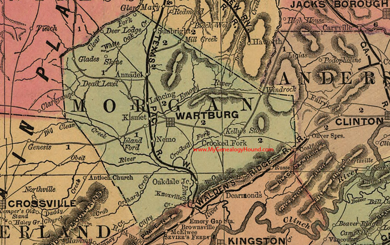
Locations shown include: Annadel, Crooked Fork, Dead Level, Deer Lodge, Glades, Island Ford, Kelly's Store, Kismet, Lancing, Mill Creek, Nemo, Oakdale Junction, Skene, Sunbright, Wartburg, Windrock
This a portion of a Tennessee map by Rand, McNally & Co. 1882, 1888
View additional Tennessee Maps here: Tennessee County Maps
County maps from other states can be viewed here: State County Maps
Use the links at the top right of this page to search or browse thousands of family biographies.