My Genealogy Hound
Macon County, Tennessee 1888 Map
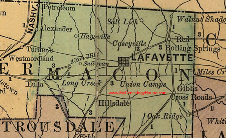
Locations shown include: Alton Hill, Caseyville, Eulia, Gibbs Cross Roads, Haysville, Hillsdale, Lafayette, Long Creek, Oak Ridge, Red Boiling Springs, Salt Lick, Sullivan, Union Camp, Walnut Shade
This a portion of a Tennessee map by Rand, McNally & Co. 1882, 1888
View family biographies from the 1887 History of Macon County: Macon County, Tennessee
View additional Tennessee Maps here: Tennessee County Maps
County maps from other states can be viewed here: State County Maps
Additional Macon County resources: Macon County, Tennessee History and Genealogy
Use the links at the top right of this page to search or browse thousands of family biographies.