My Genealogy Hound
Jefferson County, Tennessee 1888 Map
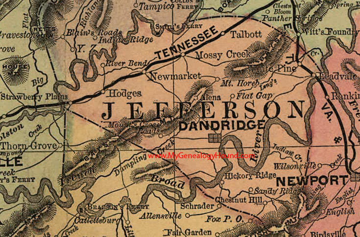
Locations shown include: Alena, Chestnut Hill, Dandridge, Flat Gap, Hickory Ridge, Hodges, Leadvale, Mossy Creek, Mt. Hoeb, Mount's Cross Roads, New Market, River Bend, Sandy Ridge, Talbott, White Pine
This a portion of a Tennessee map by Rand, McNally & Co. 1882, 1888
View family biographies from the 1887 History of Jefferson County: Jefferson County, Tennessee
View additional Tennessee Maps here: Tennessee County Maps
County maps from other states can be viewed here: State County Maps
Additional Jefferson County resources: Jefferson County, Tennessee History and Genealogy
Use the links at the top right of this page to search or browse thousands of family biographies.