My Genealogy Hound
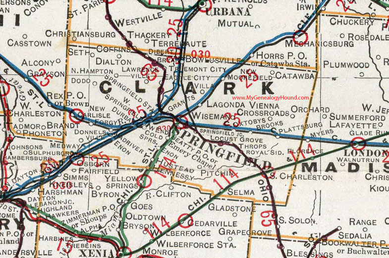
Clark County, Ohio 1901 Map

Locations shown include: Beatty P O * Brooks * Bryar * Catawba * Coffins * Cold Springs * Dialton * Dibert * Dodo * Donnelsville * Durban * Eagle City * Emery Chapel * Enon * Forgy * Grants * Hennessy * Hustead * Lawrenceville * Locust Grove * Lagonda * Mad River * Medway * New Carlisle * New Moorefield * North Hampton * Orchard * Oxtobys * Pitchin * Plattsburg * Royal Sid. * Selma * Seth * South Charleston * Springfield * Springfield Jct. * Springfield Station * Thorps (Throps) * Tremont City * Vienna Crossroads * Villa * Wend * West Springfield * Wiseman
This Clark County map is a portion of an 1901 Ohio map by Cram.
View additional Ohio Maps here: Ohio County Maps
County maps from other states can be viewed here: State County Maps
Additional Clark County resources: Clark County, Ohio History and Genealogy
Use the links at the top right of this page to search or browse thousands of family biographies.