My Genealogy Hound
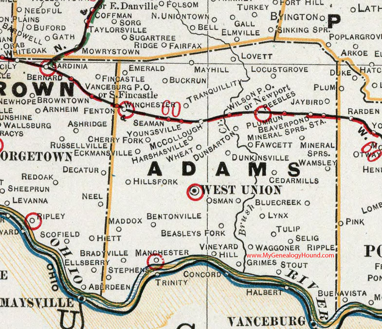
Adams County, Ohio 1901 Map

Locations shown include: Beasleys Fork * Beaver Pond * Bentonville * Bluecreek * Buckrun * Cedarmills * Cherry Fork * Dunbarton * Dunkinsville * Eckmansville * Emerald * Grimes * Harshasville * Hillsfork * Jaybird * Locust Grove * Lovett * Lynx * Manchester * Mayhill * McCollough * Mineral Springs * Mineral Springs Sta. * Newport * Osman * Peebles * Plumrun * Seaman * Selig * Stephens * Stout * Tranquillity * Tulip * Vineyard Hill * Waggoner Ripple * Wamsley * West Union * Wheat * Wilson P O * Winchester * Youngsville
This Adams County map is a portion of an 1901 Ohio map by Cram.
View additional Ohio Maps here: Ohio County Maps
County maps from other states can be viewed here: State County Maps
Use the links at the top right of this page to search or browse thousands of family biographies.