My Genealogy Hound
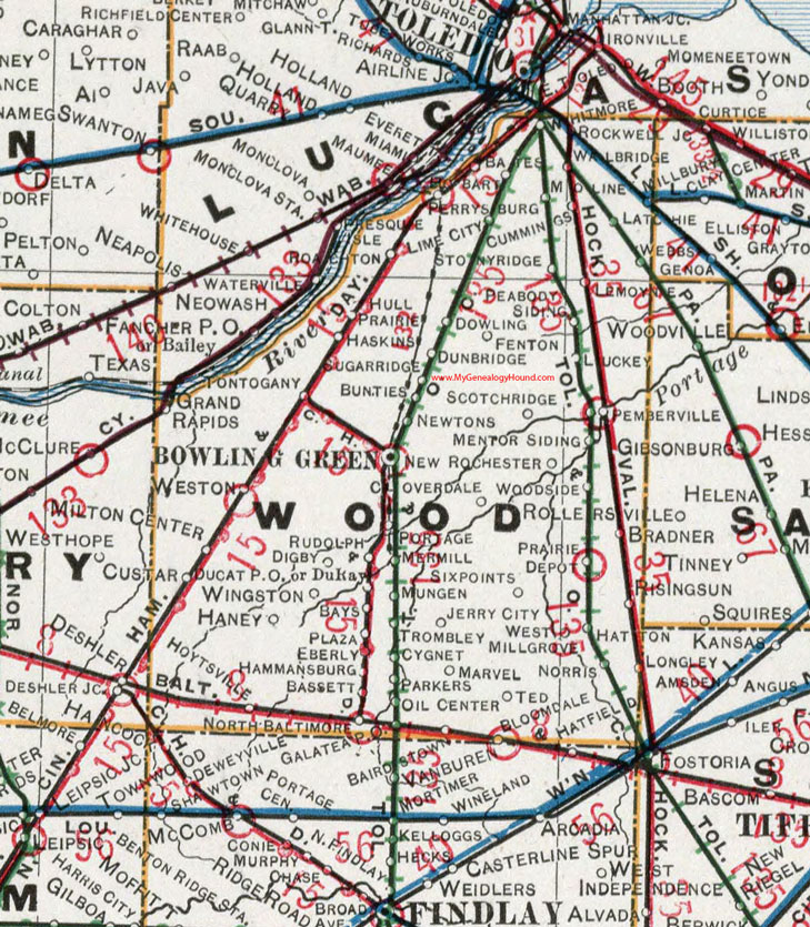
Wood County, Ohio 1901 Map

Locations shown include: Bart * Bassett * Bates * Bays * Bloomdale * Bowling Green * Bradner * Bunties * Cloverdale * Cummings * Custar * Cygnet * Digby * Dowling * Ducat P O * Dunbridge * DuRay * Eberly * Fenton * Galatea P O * Grand Rapids * Hammansburg * Haney * Haskins * Hatton * Hoytsville * Hull Prairie * Jerry City * Latchie * Lemoyne * Lime City * Luckey * Marvel * Mentor Siding * Mermill * Milton Center * Moline * Mungen * New Rochester * Newtons * Norris * North Baltimore * Oil Center * Parkers * Peabody Siding * Pemberville * Perrysburg * Plaza * Portage * Prairie Depot * Presque Isle * Risingsun * Roachton * Rockwell Junction * Rudolph * Scotch Ridge * Six Points * Stony Ridge * Sugar Ridge * Ted * Totogany * Trombley * Wallbridge * Webbs * West Millgrove * Weston * Whitmore * Wingston * Woodside *
This Wood County map is a portion of an 1901 Ohio map by Cram.
View additional Ohio Maps here: Ohio County Maps
County maps from other states can be viewed here: State County Maps
Use the links at the top right of this page to search or browse thousands of family biographies.