My Genealogy Hound
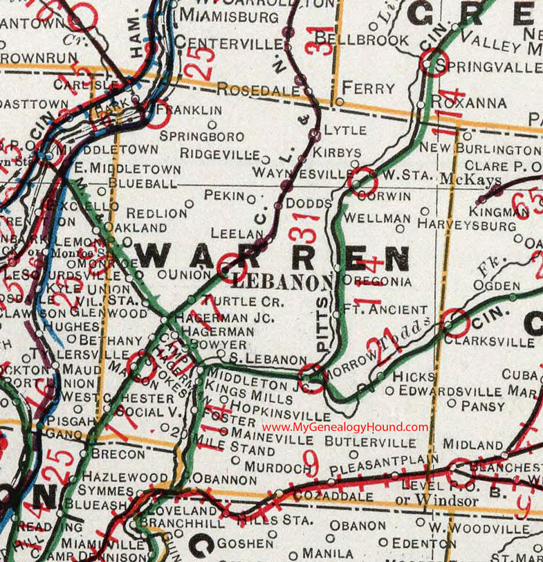
Warren County, Ohio 1901 Map

Locations shown include: Bowyer * Butlerville * Camp Hagerman * Carlisle * Corwin * Cozaddale * Dodds * Edwardsville * Fort Ancient * Foster * Franklin * Glenwood * Hagerman * Hagerman Junction * Harveysburg * Hicks * Hopkinsville * Kings Mills *Kirbys * Lebanon * Leelan * Level P O * Lytle * Maineville * Mason * Middleton Junction * Monroe * Morrow * Murdoch * Obannon * Oregonia * Park * Pekin * Pleasant Plain * Red Lion * Ridgeville * Socialville * South Lebanon * Springboro * Stokes * Twenty Mile Stand * Turtle Creek * Union * Unionville Station * Waynesville * Waynesville Station * Wellman * Windsor *
This Warren County map is a portion of an 1901 Ohio map by Cram.
View additional Ohio Maps here: Ohio County Maps
County maps from other states can be viewed here: State County Maps
Additional Warren County resources: Warren County, Ohio History and Genealogy
Use the links at the top right of this page to search or browse thousands of family biographies.