My Genealogy Hound
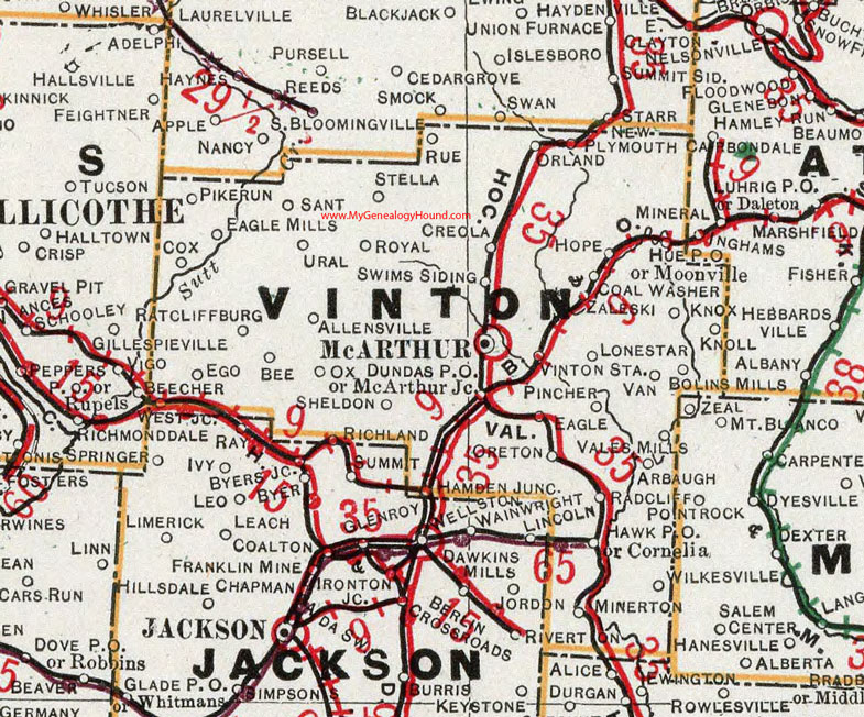
Vinton County, Ohio 1901 Map

Locations shown include: Allensville * Arbaugh * Bee * Bolins Mills * Coal Washer * Cornelia * Cox * Creola * Dundas P O * Eagle * Eagle Mills * Ego * Hamden Junction * Hawk P O * Hope * Hue P O * Knoll * Knox * Lonestar * McArthur * McArthur Junction * Minerton * Moonville * New Plymouth * Oreton * Orland * Ox * Pike Run * Pincher * Radcliff * Ratcliffsburg * Richland * Royal * Rue * Sant * Sheldon * Stella * Swims Siding * Ural * Vales Mills * Vinton Station * West Junction * Wilkesville * Zaleski *
This Vinton County map is a portion of an 1901 Ohio map by Cram.
View additional Ohio Maps here: Ohio County Maps
County maps from other states can be viewed here: State County Maps
Use the links at the top right of this page to search or browse thousands of family biographies.