My Genealogy Hound
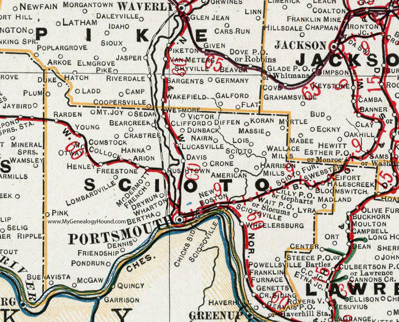
Scioto County, Ohio 1901 Map

Locations shown include: American * Arion * Bear Creek * Bertha * Bloom Switch * Buena Vista * Chicks Siding * Clifford * Comstock * Crabtree * Crone * Davis * Dennis * Diffin * Dry Run * Duke * Dunback * Eifort * Franklin Furnace * Freestone * French * Friendship * Genetts Cr. Siding * Gepharts * Gervais P O * Hales Creek * Hanna * Harrison Mills * Haverhill Station * Henley * Koran * Lilly P O * Lois * Lucasville * Lyra * Madland * Massie * McCollock * McDermott * McGaw * Mount Joy * Myrtle * Nairn * New Boston * Otway * Pink * Plum * Pond Run * Portsmouth * Powellsville * Rarden * Rushtown * Scioto * Scioto Furnace * Sciotoville * Sciotoville Junction * Sedan * Slocums * South Webster * Victor * Wait P O * Wallace Mills * Wharton * Wheelersburg * Young *
This Scioto County map is a portion of an 1901 Ohio map by Cram.
View additional Ohio Maps here: Ohio County Maps
County maps from other states can be viewed here: State County Maps
Use the links at the top right of this page to search or browse thousands of family biographies.