My Genealogy Hound
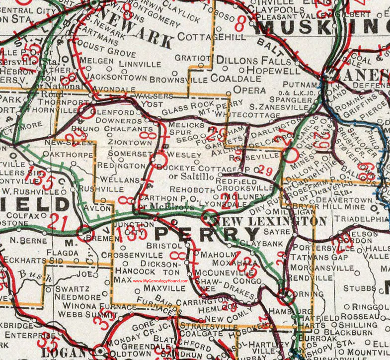
Perry County, Ohio 1901 Map

Locations shown include: Avlon * Avondale * Bristol * Bruno * Bryar * Buckeye Cottage * Carrington * Carthon P O * Chalfants * Clay Bank * Comly * Congo * Corning * Crooksville * Crosssenville * Deavertown Station * Dicksonton * Downerds * Drakes * Glass Rock * Glenford * Hamburg * Hancock * Harts * Hatfield * Hemlock * Hoboken * Junction City * Lyonsdale * Maholm * Maxville * McCuneville * McElroys * McLuney * Melicks Spur * Milligan * Mount Perry * Moxahala * New Lexington * New Straitsville * Portersville * Redfield * Redington * Rehoboth * Rendville * Rose Farm P O * Roseville * Saltillo * Sayre * Sego * Shawnee * Somerset * Tatmans Gap * Thornport * Thornville * Walser * Wellans * Wesley * Yost *
This Perry County map is a portion of an 1901 Ohio map by Cram.
View additional Ohio Maps here: Ohio County Maps
County maps from other states can be viewed here: State County Maps
Additional Perry County resources: Perry County, Ohio History and Genealogy
Use the links at the top right of this page to search or browse thousands of family biographies.