My Genealogy Hound
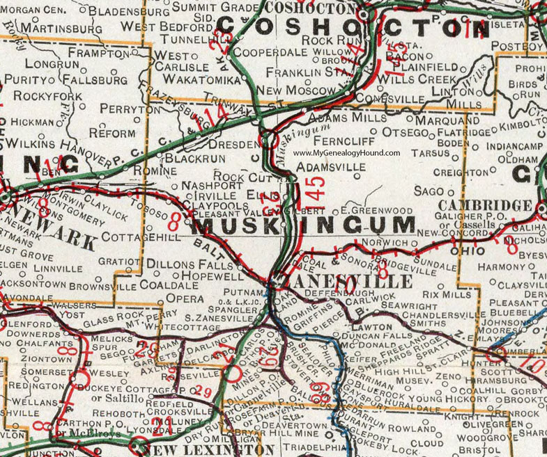
Muskingum County, Ohio 1901 Map

Locations shown include: Adams Mills * Adamsville * Axline * Ballous * Black Run * Blue Rock * Bridgeville * Brush Cr. * Carlos * Carlwick * Cedar Run * Chandlersville * Claypools * Coaldale * Coal Hill * Cottage Hill * Darlington * Deffenbaugh * Delcarbo * Dillons Falls * Dresden * Duncan Falls * East Greenwood * Frazeysburg * Freeland * Fultonham * Garrets * Gaysport * Gilbert * Griffin * Hickory * High Hill * Hopewell * Irville * Keifer * Knight * Lawton * Marquand * McDonald * Merriman * Museville * Nashport * New Concord * Norwich * Oakland * Opera * Otho * Otsego * Philo * Pierce * Pleasant Valley * Putnam * Rix Mills * Rock Cut * Romine * Roseville * Ruraldale * Sago * Saint Clair * Sealover * Seawright * Sheppards Ridge * Smith * Sonora * South Zanesville * Spangler * Spratt * Stone * Stovertown * Sundale * Tarsus * Trinway * White Cottage * Young * Zanesville * Zeno *
This Muskingum County map is a portion of an 1901 Ohio map by Cram.
View additional Ohio Maps here: Ohio County Maps
County maps from other states can be viewed here: State County Maps
Use the links at the top right of this page to search or browse thousands of family biographies.