My Genealogy Hound
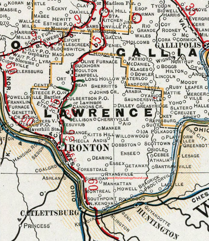
Lawrence County, Ohio 1901 Map

Locations shown include: Aid * Andis * Arabia * Athalia * Bartles * Bartramville * Bradrick * Buckhorn * Burlington * Campbell * Cannons Creek * C C Junction * Cebee * Center * Cherryville * Coal Grove * Culbertson P O * Dean * Dearing * Dilley * Dobbston * Ellison * Ensee * Essex * Etna Junction * Forestdale* Getaway * Greasy Ridge * Hanging Rock * Hecla * Howell * Ida * Ironton * Johns Creek * Kitts Hill * Labelle * LaGrange * Lawrence * Lecta * Long Hollow * Manhattan * Manker * Montreal * Moulton * North Kenova * Okey * Olive Furnace * Oriole * Ort * Platform * Polkadotte * Proctorville * Rappsburg * Rookwood * Royersville * Ryansville * Saundersville * Scottown * Sedgwick * Sheridan * Sherritts * South Point * Steece P O * Suiter * Sybene * Vesuvius * Yarico * Waterloo * Willow Wood
This Lawrence County map is a portion of an 1901 Ohio map by Cram.
View additional Ohio Maps here: Ohio County Maps
County maps from other states can be viewed here: State County Maps
Use the links at the top right of this page to search or browse thousands of family biographies.