My Genealogy Hound
Howell County, Missouri 1904 Map
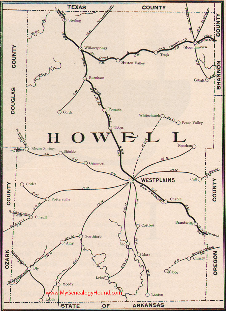
Locations shown include: Amy, Bly, Brandsville, Burnham, Chapin, Christy, Cobalt, Cordz, Cottbus, Crider, Cull, Cureall, Fanchon, Globe, Grimmet, Hutton Valley, Lanton, Lebo, Leo, Leota, Moody, Mott, Mountain View, Olden, Peace Valley, Pomona, Pottersville, Shinkle, Siloam Springs, South Fork, Sterling, Trask, West Plains, White Church, Willow Springs
View additional Missouri Maps here: Missouri County Maps
County maps from other states can be viewed here: State County Maps
Additional Howell County resources: A Reminiscent History of The Ozark Region
Use the links at the top right of this page to search or browse thousands of family biographies.