My Genealogy Hound
Bollinger County, Missouri 1904 Map
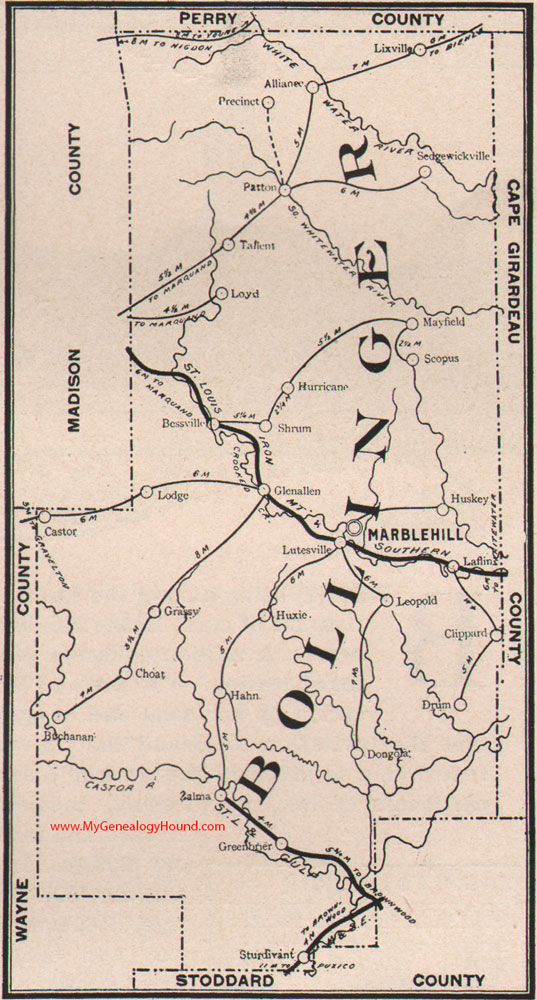
Locations shown include: Alliance, Bessville, Buchanan, Castor, Choat, Clippard, Dongola, Drum, Glen Allen, Grassy, Greenbier, Hahn, Hurricane, Huskey, Huxie, Laflin, Leopold, Lixville, Lodge, Loyd, Lutesville, Marble Hill, Mayfield, Patton, Precinct, Scopus, Sedgewickville, Shrum, Sturdivant, Tallent, Zalma
View additional Missouri Maps here: Missouri County Maps
County maps from other states can be viewed here: State County Maps
Additional Bollinger County resources: Bollinger County, Missouri History and Genealogy
Use the links at the top right of this page to search or browse thousands of family biographies.