My Genealogy Hound
Monroe County, Kentucky 1905 Map
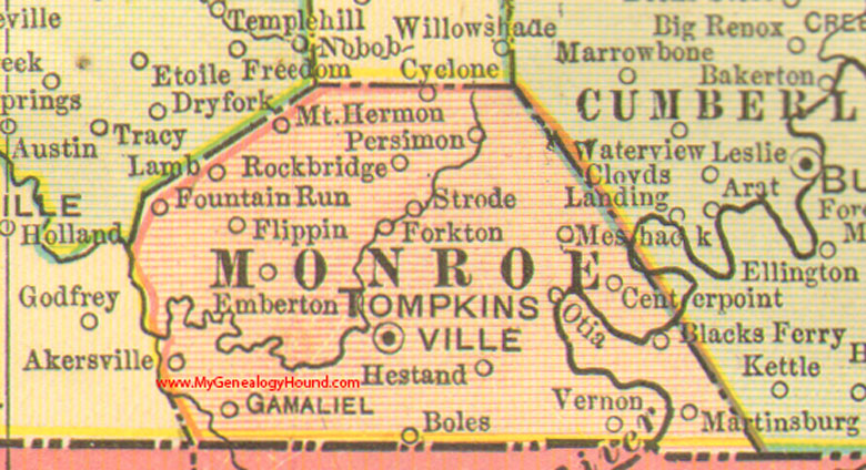
Locations shown include: Akersville, Blacks Ferry, Boles, Centerpoint, Cyclone, Emberton, Flippin, Forkton, Fountain Run, Gamaliel, Hestand, Lamb, Martinsburg, Meshack, Mt. Hermon, Otia, Persimmon, Rockbridge, Strode, Tompkinsville
This a portion of a Kentucky map from Cram's Ideal Reference Atlas, 1905
View additional Kentucky Maps here: Kentucky County Maps
County maps from other states can be viewed here: State County Maps
Additional Monroe County resources: Monroe County, Kentucky History and Genealogy
Use the links at the top right of this page to search or browse thousands of family biographies.