My Genealogy Hound
Hardin County, Kentucky 1905 Map
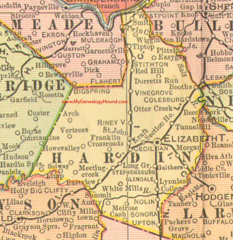
Locations shown include: Amity, Arch, Booths, Cash, Cecilia (Cecilian), Coleburg, College, Dorretts Run, Eastview, Easygap, Elizabethtown, Franklin Crossroads, Gaithers, Glendale, Hardin Springs, Howe Valley, Kraft, Limp, Long Grove, Lynnland, Meeting Creek, Middle Creek, Morgan, Nolin, Otter Creek, Red Hill, Rineyville, St. John, Smith, Solway, Sonora, Stephensburg, Stithton, Summit, Tip Top, Tunnel Hill, Upton, Vertrees, Vine Grove, West Point, White Mills, Wigginton
This a portion of a Kentucky map from Cram's Ideal Reference Atlas, 1905
View additional Kentucky Maps here: Kentucky County Maps
County maps from other states can be viewed here: State County Maps
Additional Hardin County resources: Hardin County, Kentucky History and Genealogy
Use the links at the top right of this page to search or browse thousands of family biographies.