My Genealogy Hound
Grayson County, Kentucky 1905 Map
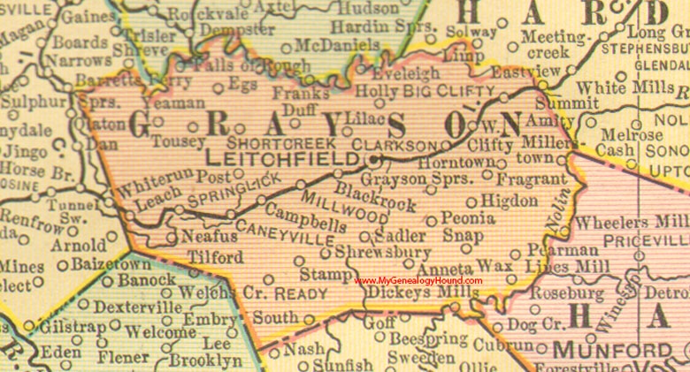
Locations shown include: Anneta, Big Clifty, Black Rock, Caneyville, Clarkson, Dickeys Mills, Duff, Egs, Edeleigh, Falls of Rough, Fragrant, Grayson Springs, Higdon, Holly, Horntown, Leach, Leitchfield, Lilac, Millerstown, Millwood, Neafus, Pearman, Peonia, Post, Ready, Sadler, Short Creek, Shrewsbury, Snap, South, Spring Lick, Stamp, Tousey, Wax, West Clifty, Wheelers Mill, Yeaman
This a portion of a Kentucky map from Cram's Ideal Reference Atlas, 1905
View additional Kentucky Maps here: Kentucky County Maps
County maps from other states can be viewed here: State County Maps
Additional Grayson County resources: Grayson County, Kentucky History and Genealogy
Use the links at the top right of this page to search or browse thousands of family biographies.