My Genealogy Hound
Pawnee County, Kansas 1887 Map
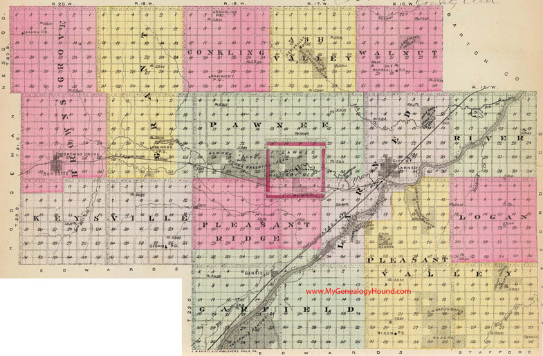
Locations shown include (click on any township name for an enlarged view):
Ash Valley Township: Ash Valley
Browns Grove Township: Browns Grove, Burdette, Lanark
Conkling Township: Conkling, Harmony
Garfield Township: Garfield
Grant Township: Ben Wade
Keysville Township: George
Larned Township: Larned
Logan Township
Pawnee Township: Ft. Larned Military Reservation
Pleasant Ridge Township:Ft. Larned Military Reservation (partial)
Pleasant Valley Township: Nixon
River Township
Walnut Township: Marshall
The names shown in all caps are the names of the townships
This a map from Official State Atlas of Kansas, by L. H. Everts & Co., 1887
View additional Kansas Maps here: Kansas County Maps
County maps from other states can be viewed here: State County Maps
Use the links at the top right of this page to search or browse thousands of family biographies.