My Genealogy Hound
Morris County, Kansas 1911 Map
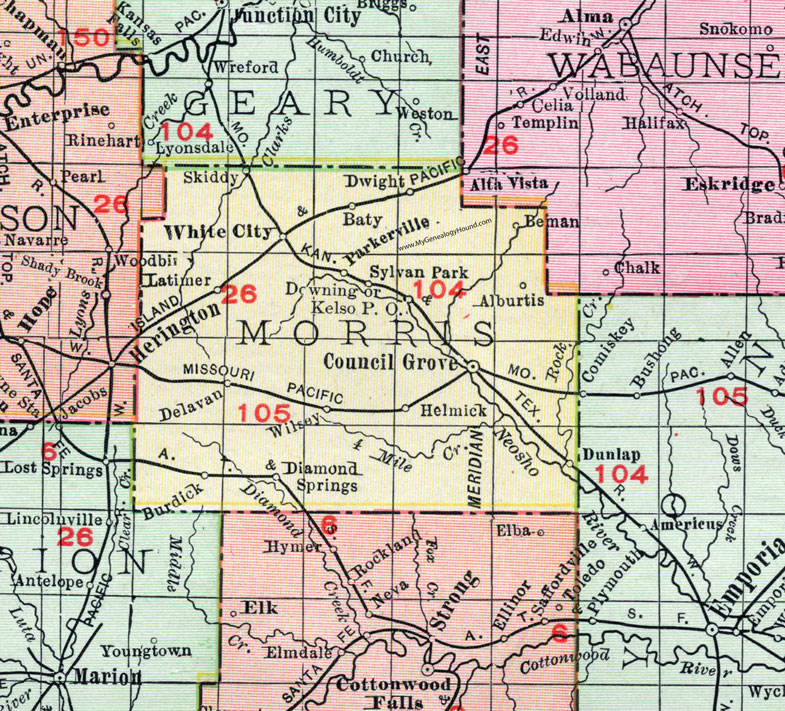
Locations shown include: Alburtis, Baty, Beman, Burdick, Council Grove, Delavan, Diamond Springs, Downing, Dunlap, Dwight, Helmick, Kelso P.O., Latimer, Parkersville, Skiddy, Sylvan Park, White City, Wilsey.
This Morris County map is a portion of a 1911 Kansas map by Rand McNally.
View additional Kansas County Maps here: Kansas County Maps
County maps from other states can be viewed here: State County Maps
Use the links at the top right of this page to search or browse thousands of family biographies, historic maps, vintage photos and postcards.