My Genealogy Hound
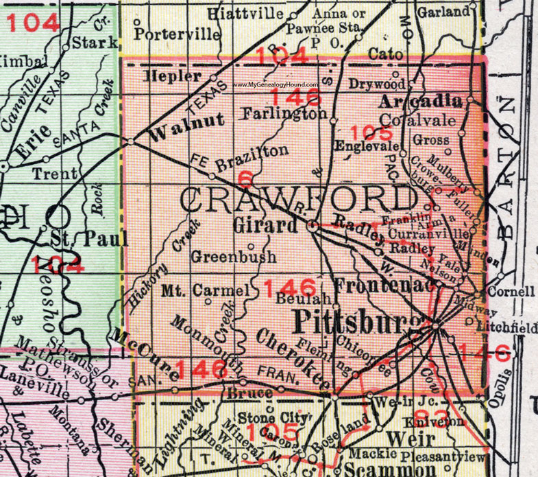
Crawford County, Kansas 1911 Map

Locations shown include: Arcadia, Arma, Beulah, Brazilton, Bruce, Cherokee, Chicopee, Coalvale, Cornell, Croweburg, Curranville, Drywood, Englevale, Farlington, Fleming, Franklin, Frontenac, Fuller, Girard, Greenbush, Gross, Hepler, Litchfield, McCune, Midway, Minden, Monmouth, Mount Carmel, Mulberry, Nelson, Opolis, Pittsburg, Radley, Walnut, Weir Junction, Yale.
This Crawford County map is a portion of a 1911 Kansas map by Rand McNally.
View additional Kansas County Maps here: Kansas County Maps
County maps from other states can be viewed here: State County Maps
Use the links at the top right of this page to search or browse thousands of family biographies, historic maps, vintage photos and postcards.