My Genealogy Hound
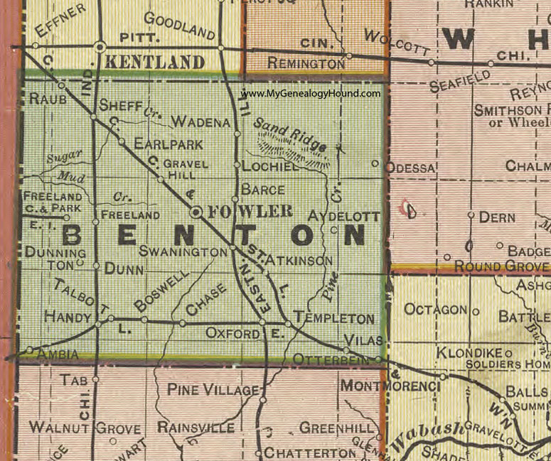
Benton County, Indiana 1908 Map

Locations shown include: Ambia, Atkinson, Aydelott, Barce, Boswell, Chase, Dunn, Dunnington, Earl Park, Fowler, Freeland, Freeland Park, Gravel Hill, Handy, Lochiel, Odessa, Otterbein, Oxford, Raub, Sand Ridge, Sheff, Swanington, Talbot, Templeton, Vilas, Wadena
This a portion of a map by Geo. A. Ogle & Co., 1908
View additional Indiana Maps: Indiana County Maps
County maps from other states can be viewed here: State County Maps
Use the links at the top right of this page to search or browse thousands of family biographies.