My Genealogy Hound
Vermilion County, Illinois 1881 Map
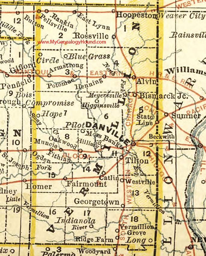
Locations shown include: Alvin, Armstrong, Bismarck Junction, Blue Grass, Catlin, Circle, Danville, East Lynn, Fairmount, Fithian, Georgetown, Henning, Higginsville, Hilliary, Hoopeston, Hope, Indianola, Long, Meyersville, Moss Bank, Muncie, Oakwood, Pellsville, Pilot, Potomac, Rankin, Ridge Farm, Rossville, State Line, Tilton, Vermillion Grove, Westville
This a portion of a map by Rand McNally, 1881.
View additional Illinois Maps here: Illinois County Maps
County maps from other states can be viewed here: State County Maps
Use the links at the top right of this page to search or browse thousands of family biographies, historic maps, and vintage photos and postcards.