My Genealogy Hound
Van Buren County, Arkansas 1889 Map
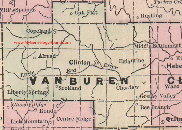
Locations shown include: Alread, Bee Branch, Choctaw, Clinton, Copeland, Eglantine, Greasy Valley, Liberty Springs, Middle Settlement, Oak Flat, Scotland
This is a portion of a Arkansas map published by Bradley, circa 1889.
View additional Arkansas Maps here: Arkansas County Maps
County maps from other states can be viewed here: State County Maps
Additional Van Buren County resources: A Reminiscent History of The Ozark Region
Use the links at the top right of this page to search or browse thousands of family biographies.