My Genealogy Hound
Scott County, Arkansas 1889 Map
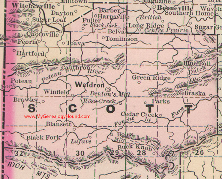
Locations shown include: Barber, Belva, Black Fork, Black Jack, Blansett, Blue Ball, Boles, Brawley, Buck Knob, Cauthron, Cedar Creek, Denton's Mill, Fuller, Green Ridge, Harpsville, Lafave, Nebraska, Olio, Poteau, Ross Creek, Tomlinson, Waldron, Winfield
This is a portion of a Arkansas map published by Bradley, circa 1889.
View family biographies from the 1891 History of Scott County: Scott County, Arkansas
View additional Arkansas Maps here: Arkansas County Maps
County maps from other states can be viewed here: State County Maps
Additional Scott County resources: Scott County, Arkansas History, Genealogy, and Maps
Use the links at the top right of this page to search or browse thousands of family biographies.