My Genealogy Hound
Columbia County, Arkansas 1889 Map
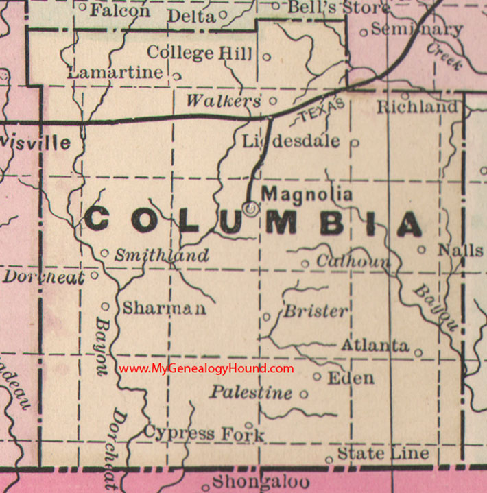
Locations shown include: Atlanta, Brister, Calhoun, College Hill, Cypress Fork, Dorcheat, Eden, Lamartine, Liddesdale, Magnolia, Nalls, Palestine, Richland, Sharman, Smithland, State Line, Walkers
This is a portion of a Arkansas map published by Bradley, circa 1889.
View family biographies from the 1890 History of Columbia County: Columbia County, Arkansas
View additional Arkansas Maps here: Arkansas County Maps
County maps from other states can be viewed here: State County Maps
Additional Columbia County resources: Columbia County, Arkansas History, Genealogy, and Maps
Use the links at the top right of this page to search or browse thousands of family biographies.