My Genealogy Hound
Carroll County, Arkansas 1889 Map
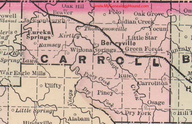
Locations shown include: Beaver, Berryville, Carrollton, Dry Fork, Eureka Springs, Green Forest, Indian Creek, Jacksonburgh, Kirtley, Little Star, Nunnaly, Oak Grove, Oak Hill, Osage, Piney, Polo, Ramsey, Rule, Spring Lawn, Thompsonville, Winona Springs, Yocum
This is a portion of a Arkansas map published by Bradley, circa 1889.
View family biographies from the 1889 History of Carroll County: Carroll County, Arkansas
View additional Arkansas Maps here: Arkansas County Maps
County maps from other states can be viewed here: State County Maps
Additional Carroll County resources: Carroll County, Arkansas History, Genealogy, and Maps
Use the links at the top right of this page to search or browse thousands of family biographies.