My Genealogy Hound
Benton County, Arkansas 1898 Map
View additional Benton County Maps here: Benton County, Arkansas Maps
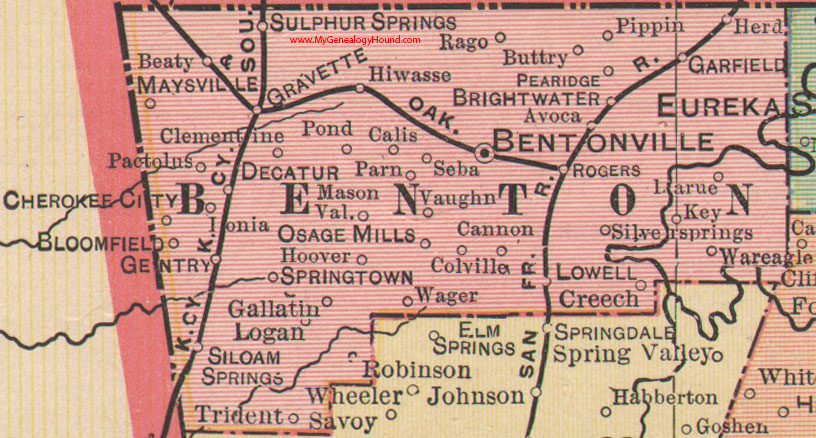
Locations shown include: Avoca, Beaty, Bentonville, Bloomfield, Brightwater, Buttry, Calis, Cannon, Cherokee City, Clementine, Colville, Creech, Decatur, Gallatin, Garfield, Gentry, Gravette, Herd, Hiwasse, Hoover, Ionia, Key, Larue, Logan, Lowell, Mason Valley, Maysville, Osage Mills, Pactolus, Parn, Pea Ridge, Pippin, Pond, Rago, Robinson, Rogers, Seba, Siloam Springs, Silver Springs, Springtown, Sulphur Springs, Trident, Vaughn, Wager, War Eagle
This is a portion of a Arkansas map published by George F. Cram in 1898.
View family biographies from the 1889 History of Benton County: Benton County, Arkansas
View additional Benton County Maps here: Benton County, Arkansas Maps
View additional Arkansas Maps here: Arkansas County Maps
County maps from other states can be viewed here: State County Maps
Additional Benton County resources: Benton County, Arkansas History, Genealogy, and Maps
Use the links at the top right of this page to search or browse thousands of family biographies.