My Genealogy Hound
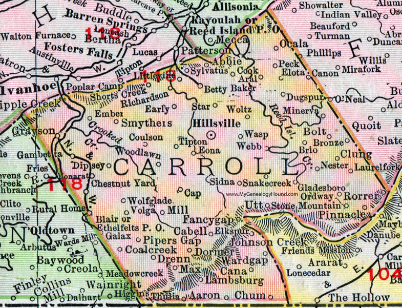
Carroll County, Virginia 1911 Map

Locations shown include: Aaron * Abbie * Aral * Betty Baker * Bolt * Brio * Bronze * Cabell * Cana * Canon * Cap * Chestnut Yard * Chum * Clung * Coalcreek (Coal Creek) * Cook * Coulson * Dipsey * Dormer * Drenn * Dugspur * Early * Elkspur (Elk Spur) * Elota * Ember * Eona * Ethelfelts P O * Fancygap (Fancy Gap) * Galax * Gambetta * Gladesboro * Grayson * Hillsville * Lambsburg * Laurelfork (Laurel Fork) * Littlevine * Max * Mill * Minerva * Monarat * Nester * Ocala * Ordway * Peck * Pinnacle * Pipers Gap * Richardson * Rorrer * Shorts Creek * Sidna * Smythers * Snakecreek * Star * Stone Mountain * Sylvatus * Thulia * Tipton * Utt * Volga * Wardgap * Wasp * Webb * Wolfglade (Wolf Glade) * Woltz * Woodlawn *
This Carroll County map is a portion of a 1911 Virginia map by Rand McNally.
View additional Virginia Maps here: Virginia County Maps
County maps from other states can be viewed here: State County Maps
Use the links at the top right of this page to search or browse thousands of family biographies.