My Genealogy Hound
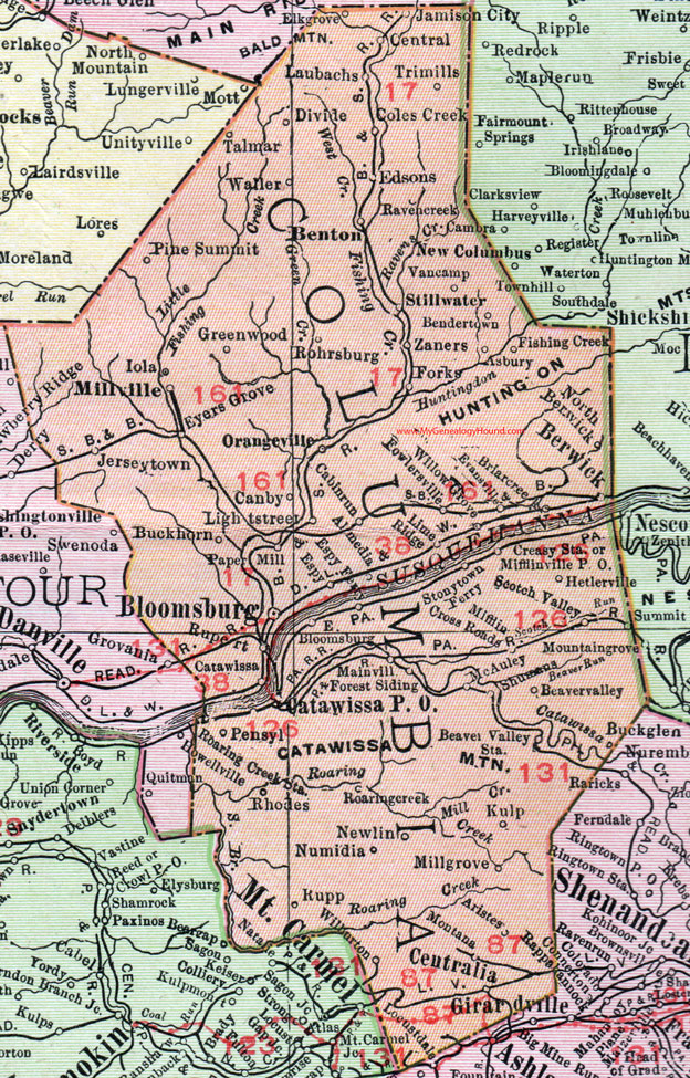
Columbia County, Pennsylvania 1911 Map

Locations shown include: Almedia * Aristes * Asbury * Beavervalley (Beaver Valley) * Beaver Valley Station * Bendertown * Benton * Berwick * Bloomsburg * Briarcreek (Briar Creek) * Buckhorn * Cabinrun * Canby * Catawissa * Catawissa P O * Central * Centralia * Coles Creek * Creasy Station * Divide * East Bloomsburg * Edsons * Elkgrove (Elk Grove) * Espy * Espy Ferry * Eyers Grove * Fishing Creek * Forest Siding * Forks * Fowlersville * Greenwood * Hetlerville * Iola * Jamison City * Jerseytown * Kulp * Laubachs * Lightstreet (Light Street) * Lime Ridge * Mainville * McAuley * Mifflin Cross Roads * Mifflinville P O * Millgrove (Mill Grove) * Millville * Montana * Newlin * North Berkwick * Numidia * Orangeville * Paper Mill * Pine Summit * Ravencreek * Rhodes * Roaring Creek * Roaring Creek Station * Rohrsburg * Rupert * Rupp * Scotch Valley * Shumans * Stillwater * Stonytown Ferry * Talmar * Trimills (Tri Mills) * Vancamp * Waller * Wilburton * Willow Grove * Zaners *
This Columbia County map is a portion of an 1911 Pennsylvania map by Rand McNally.
View additional Pennsylvania Maps here: Pennsylvania County Maps
County maps from other states can be viewed here: State County Maps
Use the links at the top right of this page to search or browse thousands of family biographies.