My Genealogy Hound
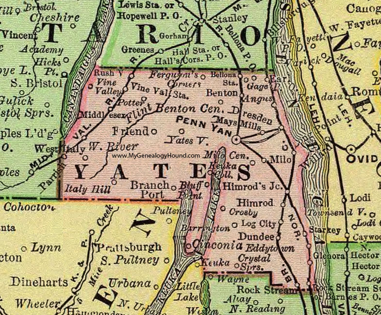
Yates County, New York 1897 Map

Locations shown include: Angus * Barnes P O * Barrington * Bellona Station * Benton * Benton Center * Bluff Point * Branch Port * Cinconia * Crosby * Crystal Springs * Dresden * Dundee * Earl * Eddytown * Ferguson's Corners * Friend * Gage P O * Glenora * Himrod * Himrod's Junction * Italy Hill * Keuka Coll. * Log City * Mays Mills * Middlesex * Milo * Milo Center * Penn Yan * Potter * Rock Stream * Rock Stream Station * Rushville * Starkey * Vine Valley * Vine Valley Station * West Italy * Yatesville *
This Yates County map is a portion of an 1897 New York map by Rand McNally.
View additional New York Maps here: New York County Maps
County maps from other states can be viewed here: State County Maps
Use the links at the top right of this page to search or browse thousands of family biographies.