My Genealogy Hound
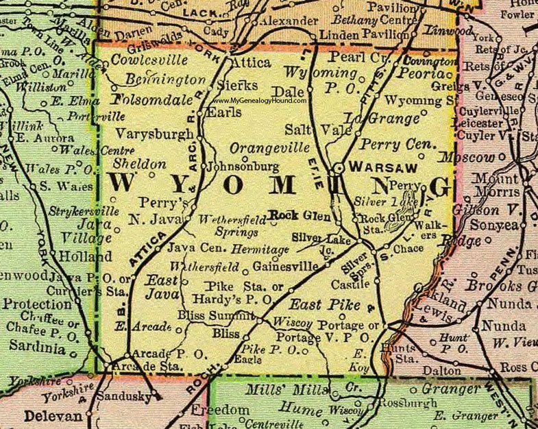
Wyoming County, New York 1897 Map

Locations shown include: Arcade P O * Arcade Station * Attica * Bennington * Bliss * Bliss Summit * Castile * Chace * Covington * Cowlesville * Currier's Station * Dale * Eagle * East Arcade * East Java * East Koy * East Pike * Earls * Folsomdale * Gainesville * Hermitage * Java Center * Java P O * Java Village * Johnsonburg * La Grange * North Java * Orangeville * Pearl Creek * Peoria * Perry * Perry Center * Perry's * Pike P O * Portage * Portageville P O * Rock Glen * Rock Glen Station * Salt Vale * Sheldon * Sierks * Silver Lake * Silver Lake Junction * Silver Springs * Strykersville * Varysburgh (Varysburg) * Walkers * Warsaw * Wethersfield * Wiscoy * Wyoming P O * Wyoming Station *
This Wyoming County map is a portion of an 1897 New York map by Rand McNally.
View additional New York Maps here: New York County Maps
County maps from other states can be viewed here: State County Maps
Use the links at the top right of this page to search or browse thousands of family biographies.