My Genealogy Hound
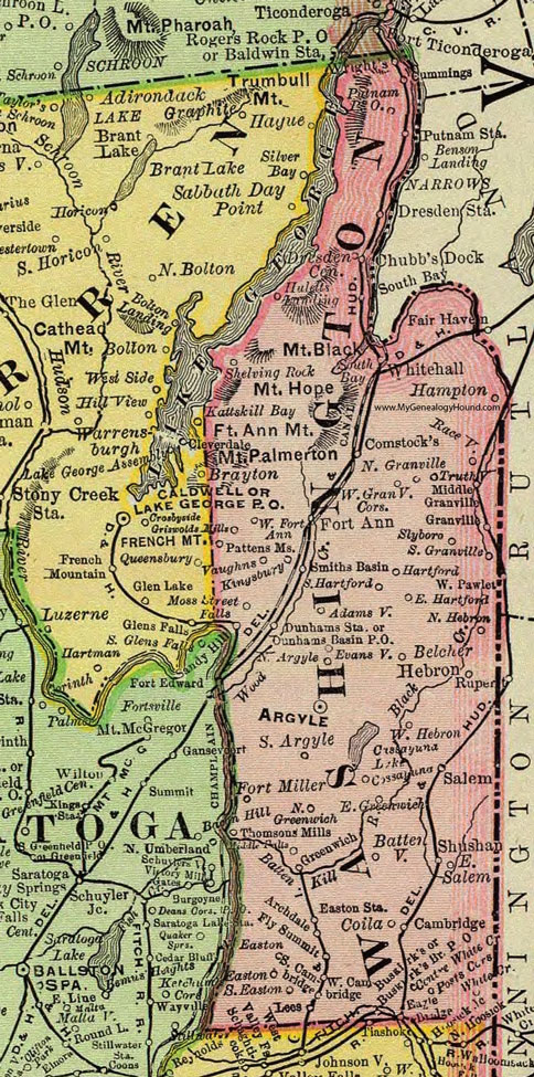
Washington County, New York 1897 Map

Locations shown include: Adamsville * Archdale * Argyle * Battenville * Belcher * Cambridge * Chubb's Dock * Coila * Comstocks * Cossayuna * Dresden Center * Dresden Station * Dunhams Basin P O * Dunhams Station * East Greenwich * East Hartford * East Salem * Easton * Easton Station * Evansville * Fly Summit * Fort Ann * Fort Miller * Granville * Greenwich * Griswold Mills * Hampton * Hartford * Hebron * Huletts Landing * Kingsbury * Lees * Middle Falls * Middle Granville * Moss Street Falls * North Argyle * North Easton * North Granville * North Greenwich * North Hebron * Pattens Mills * Posts Corners * Putnam P O * Putnam Station * Raceville * Salem * Sandy Hill * Shelving Rock * Shushan * Slyboro * Smiths Basin * South Argyle * South Bay * South Cambridge * South Easton * South Granville * South Hartford * Thomsons Mills * Truthville * Vaughns * West Cambridge * West Fort Ann * West Granville Corners * West Hebron * West Pawlet * Whitehall * White Crossing * Wrights *
This Washington County map is a portion of an 1897 New York map by Rand McNally.
View additional New York Maps here: New York County Maps
County maps from other states can be viewed here: State County Maps
Use the links at the top right of this page to search or browse thousands of family biographies.