My Genealogy Hound
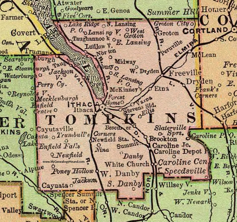
Tompkins County, New York 1897 Map

Locations shown include: Asbury * Besemer * Brookton * Caroline Center * Caroline Depot P O * Caroline Junction * Cayuata * Danby * Dryden * East Lansing * Ellis * Elmira * Enfield Centre * Enfield Falls * Etna * Forest Home * Freeville * Groton * Groton City * Ithaca * Jackson * Jacksonville * Lake Ridge P O * Lansingville * Ludlowville * McKinneys * McLean * Midway * Newfield * Newfield Station * Nina * North Lansing * Norton * Peruville * Poney Hollow * Slaterville Springs * South Danby * South Lansing P O * Speedsville * Stevens Siding * Summit * Taughannock * Taughannock Falls * Trumansburgh * Trumbulls Corners * Varna * Waterburg * West Danby * West Dryden * West Groton * White Church *
This Tompkins County map is a portion of an 1897 New York map by Rand McNally.
View additional New York Maps here: New York County Maps
County maps from other states can be viewed here: State County Maps
Use the links at the top right of this page to search or browse thousands of family biographies.