My Genealogy Hound
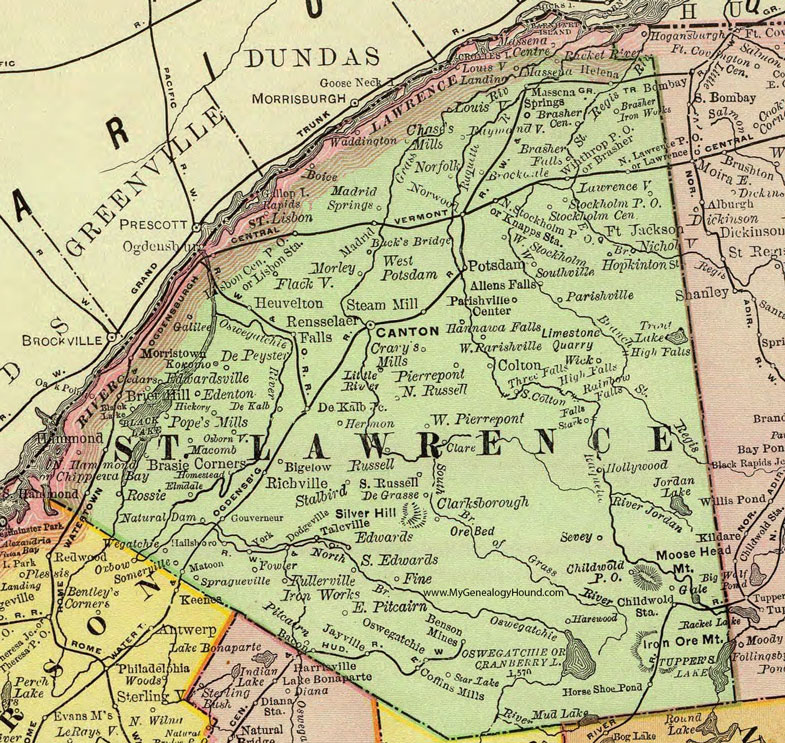
St. Lawrence County, New York 1897 Map

Locations shown include: Allens Falls * Bacon * Benson Mines * Bigelow * Black Lake * Boice * Brasher * Brasher Center * Brasher Falls * Brasher Iron Works * Brasie Corners * Brier Hill * Brockville * Bucks Bridge * Canton * Cedars * Chases's Mills * Childwold P O * Childwold Station * Chippewa Bay * Clare * Clarksborough * Coffins Mills * Colton * Cranberry Lake * Crary's Mills * De Grasse * De Kalb * De Kalb Junction * De Peyster * Dodgeville * East Pitcairn * Edenton * Edwards * Edwardsville * Elmdale * Fine * Flackville * Fort Jackson * Fowler * Fullerville Iron Works * Gale * Galilee * Gouverneur * Hallsboro * Hammond * Hannawa Falls * Harewood * Helena * Hermon * Heuvelton * Hickory * Hollywood * Homestead * Hopkinton * Horseshoe Pond * Jayville * Knapps Station * Kokomo * Lawrence * Lawrenceville * Lisbon * Lisbon Center P O * Lisbon Station * Louisville * Louisville Landing * Macomb * Madrid * Madrid Springs * Massena * Massena Centre * Massena Springs * Matoon * Morley * Morristown * Natural Dam * Nicholville * Norfolk * North Hammond * North Lawrence P O * North Russell * North Stockholm P O * Norwood * Ogdensburg * Osbornville * Oswegatchie * Parishville * Parishville Center * Pierrepont * Pitcairn * Pope's Mills * Potsdam * Racket River * Raymondville * Rensselaer Falls * Richville * Rossie * Russell * Sevey * Somerville * South Colton * South Edwards * South Russell * Southville * Spragueville * Stalbird * Stark * Star Lake * Steam Mill * Stockholm Center * Stockholm P O *Talcville * Waddington * Wegatchie * West Parishville * West Pierrepont * West Potsdam * West Stockholm * Wick * Winthrop P O * York *
This St. Lawrence County map is a portion of an 1897 New York map by Rand McNally.
View additional New York Maps here: New York County Maps
County maps from other states can be viewed here: State County Maps
Use the links at the top right of this page to search or browse thousands of family biographies.