My Genealogy Hound
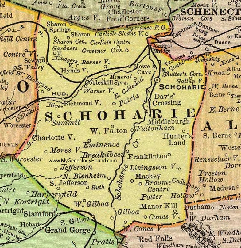
Schoharie County, New York 1897 Map

Locations shown include: Barnerville * Breakabeen * Broome Center * Carlisle * Carlisle Centre * Charlotteville * Cobleskill * Conesville * Davis' Crossing * East Cobleskill * Eminence * Esperance P O * Franklinton * Fultonham * Gallupville * Gardnersville * Gilboa * Grovenor Corners * Howes Cave * Hunter's Land * Hyndsville * Jefferson * Lawyersville * Livingstonville * Mackey * Manor Kill * Middleburgh (Middleburg) * Mineral Springs * Moresville * North Blenheim * Patria * Richmondville * Ruth * Schoharie * Sharon * Sharon Center * Sharon Springs * Shutter's Corners * Sloansville * South Gilboa * South Jefferson * Summit * Vromans * Warnerville * West Conesville * West Fulton * West Gilboa * West Richmondville *
This Schoharie County map is a portion of an 1897 New York map by Rand McNally.
View additional New York Maps here: New York County Maps
County maps from other states can be viewed here: State County Maps
Use the links at the top right of this page to search or browse thousands of family biographies.