My Genealogy Hound
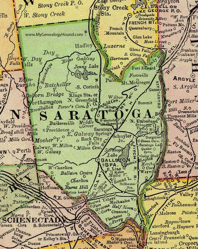
Saratoga County, New York 1897 Map

Locations shown include: Bacon Hill * Ballston Centre * Ballston Lake * Ballston Spa * Barkersville * Batchellerville * Bemus * Bemus Heights * Burgoyne * Burnt Hill * Cedar Bluff * Charlton * Clifton Park * Conklingville * Coon * Corinth Station * Crescent * Day * Deans Corners P O * East Galway * East Line * Edinburgh * Elnora * Fort Edward * Fortsville * Galway * Gansevoort * Gates * Glenville Station * Greenfield * Greenfield Center * Greenfield P O * Grooms Corners * Hadley * Half Moon * Ketchum Corners * Kings Station * Malta * Maltaville * Mechanicsville * Middle Grove * Milton Center * Mosherville * Mount McGregor * North Greenfield P O * North Umberland * Palmer * Porters Corners * Providence * Quaker Springs * Rexford Flats * Rock City Falls * Round Lake * Sandy Hill * Saratoga Lake Station * Saratoga Springs * Schuyler Junction * Schuylerville * South Corinth * Stillwater * Stillwater Station * Summit * Ushers * Victory Mills * Vischens Ferry * Waterford * Wayville * West Charlton * West Day * West Galway * West Milton * West Providence * Wilton *
This Saratoga County map is a portion of an 1897 New York map by Rand McNally.
View additional New York Maps here: New York County Maps
County maps from other states can be viewed here: State County Maps
Use the links at the top right of this page to search or browse thousands of family biographies.