My Genealogy Hound
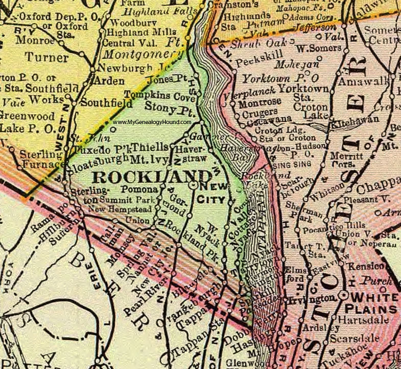
Rockland County, New York 1897 Map

Locations shown include: Blauvelt * Congers * Garnerville * Germond * Haverstraw * Hillburn * Jones Point * Monsey * Mount Ivy * Nanuet * New City * New City Junction * New Hempstead * Nyack * Orangeburgh * Palisades * Pearl River * Piermont * Pomona * Ramapo * Rockland Lake * Rockland Park * Sloatsburgh (Sloatsburg) * South Nyack * Sparkill * Spring Valley * Sterlington * Stony Point * Suffern * Summit Park * Tallman * Tappan * Tappan Station * Thiells * Tompkins Cove * Union * Valley Cottage * West Nyack *
This Rockland County map is a portion of an 1897 New York map by Rand McNally.
View additional New York Maps here: New York County Maps
County maps from other states can be viewed here: State County Maps
Use the links at the top right of this page to search or browse thousands of family biographies.