My Genealogy Hound
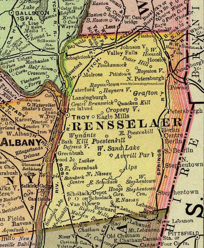
Rensselaer County, New York 1897 Map

Locations shown include: Alps * Averill Park * Berlin * Boyntonville * Brainard * Brunswick * Castleton * Centre Berlin * Cropseyville * Defreestville * Eagle Mills * East Greenbush * East Nassau * East Poestenkill * East Schaghticoke * East Schodack * Grafton * Greenbush * Haynersville * Hoags Corners * Hoosick * Hoosick Falls * Hoosick Junction * Johnsonville * Lansingburgh * Melrose * Muitzeskill * North Hoosick * North Nassau * North Petersburgh * North Stephentown * Petersburgh * Petersburgh Junction * Pittstown * Poestenkill * Potter Hill * Quacken Kil * Raymertown * Reynolds * Schaghticoke * Schodack * Schodack Centre * Schodack Depot P O * Schodack Landing * South Berlin * Stephentown * Stephentown Centre * Tiashoke * Tomhannock * Troy * Valley Falls * Van Hoesen * Walloomsack * Waterford * Waterford Junction * West Hoosick * West Sand Lake * West Stephentown * West Valley Falls * Wynantskill *
This Rensselaer County map is a portion of an 1897 New York map by Rand McNally.
View additional New York Maps here: New York County Maps
County maps from other states can be viewed here: State County Maps
Use the links at the top right of this page to search or browse thousands of family biographies.