My Genealogy Hound
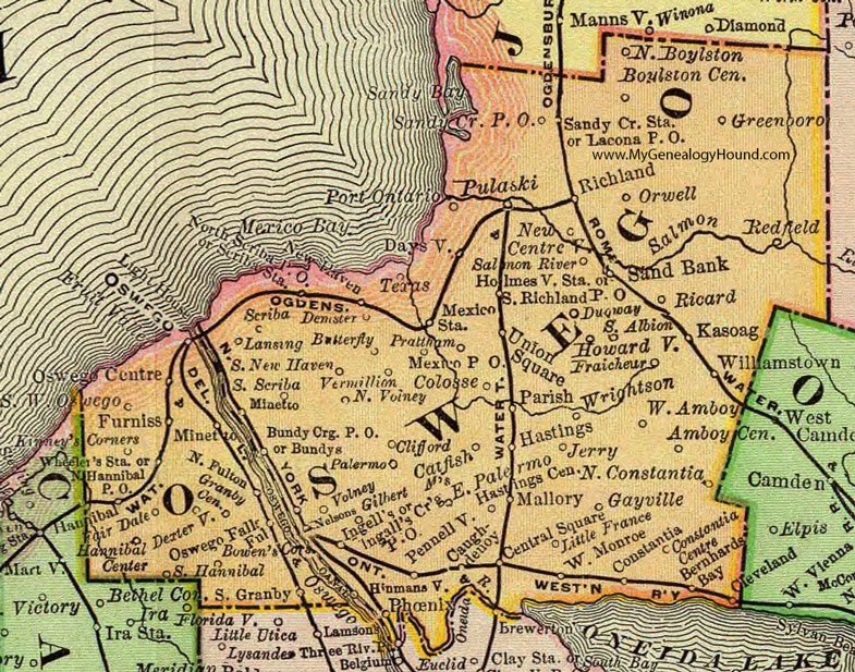
Oswego County, New York 1897 Map

Locations shown include: Amboy Center * Bernhards Bay * Bowen's Corners * Boyleston Center * Bundy Crossing P O * Bundys * Butterfly * Catfish Mills * Caughdenoy * Central Square * Cleveland * Clifford * Colosse * Constantia * Constantia Centre * Daysville * Demster * Dexterville * Dugway * Fair Dale * Fraicheur * Fruit Valley * Furniss * Gayville * Gilbert Mills * Granby Center * Greenboro * Hannibal * Hannibal Center * Hastings * Hastings Center * Holmesville Station * Howardville * Humansville * Ingall's Corners P O * Ingell's * Jerry * Kasoag * Kinney's Corners * Lacona P O * Lansing * Little France * Mallory * Mexico P O * Mexico Station * Minetto * Nelsons * New Centreville * New Haven * North Boyleston * North Fulton * North Hamilton P O * North Scriba P O * North Volney * Orwell * Oswego * Oswego Centre * Oswego Falls * Palermo * Parish * Pennellville * Phoenix * Port Ontario * Prattham * Pulaski * Redfield * Ricard * Richland * Salmon River * Sand Bank * Sandy Creek P O * Sandy Creek Station * Scriba * Scriba Station * South Albion * South Granby * South Hannibal * South New Haven * South Richland P O * South Scriba * Southwest Oswego * Texas * Union Suare * Vermillion * Volney * West Amboy * West Monroe * Wheeler's Station * Williamstown * Wrightson *
This Oswego County map is a portion of an 1897 New York map by Rand McNally.
View additional New York Maps here: New York County Maps
County maps from other states can be viewed here: State County Maps
Use the links at the top right of this page to search or browse thousands of family biographies.