My Genealogy Hound
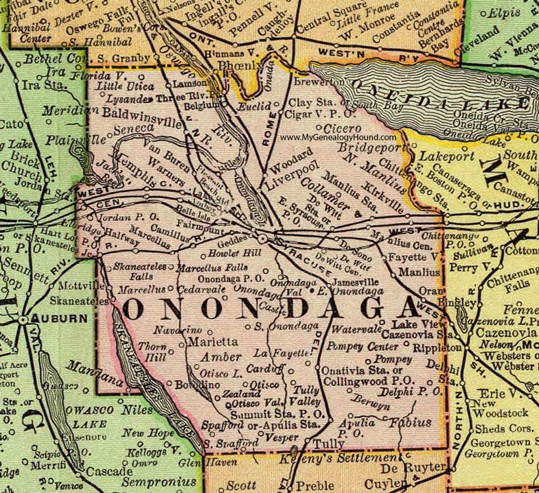
Onondaga County, New York 1897 Map

Locations shown include: Amber * Amboy * Apulia P O * Apulia Station * Baldwinsville * Belgium * Belle Isle * Berwyn * Borodino * Brewerton * Camillus * Cardiff * Cedarvale * Cicero * Cigarville P O * Clay Station * Collamer * Collingwood P O * Delphi P O * De Sono * De Witt * De Witt Center * De Witt Station * East Onondaga * East Syracuse P O * Elbridge * Euclid * Fabius * Fairmount * Fayetteville * Geddes * Halfway * Hart Lot P O * Howlet Hill * Jack's Reef * Jamesville * Jordan P O * Kirkville * La Fayette * Lake Side * Lamson * Little Utica * Liverpool * Lysander * Manlius * Manlius Centre * Manlius Station * Marcellus * Marcellus Falls * Marietta * Memphis * Navarino * North Manlius * Onativia Station * Onondaga Castle * Onondaga P O * Onondaga Valley * Oran * Otisco * Otisco Valley * Plainville * Pleasant Beach * Pompey * Pompey Center * Skaneateles Falls * Skaneateles Junction * South Onondaga * South Spafford * Spafford * Stiles * Summit Station P O * Syracuse * Thorn Hill * Three River Point * Tully * Tully Valley * Van Buren * Vesper * Warners * Watervale * Woodard * Zealand *
This Onondaga County map is a portion of an 1897 New York map by Rand McNally.
View additional New York Maps here: New York County Maps
County maps from other states can be viewed here: State County Maps
Use the links at the top right of this page to search or browse thousands of family biographies.