My Genealogy Hound
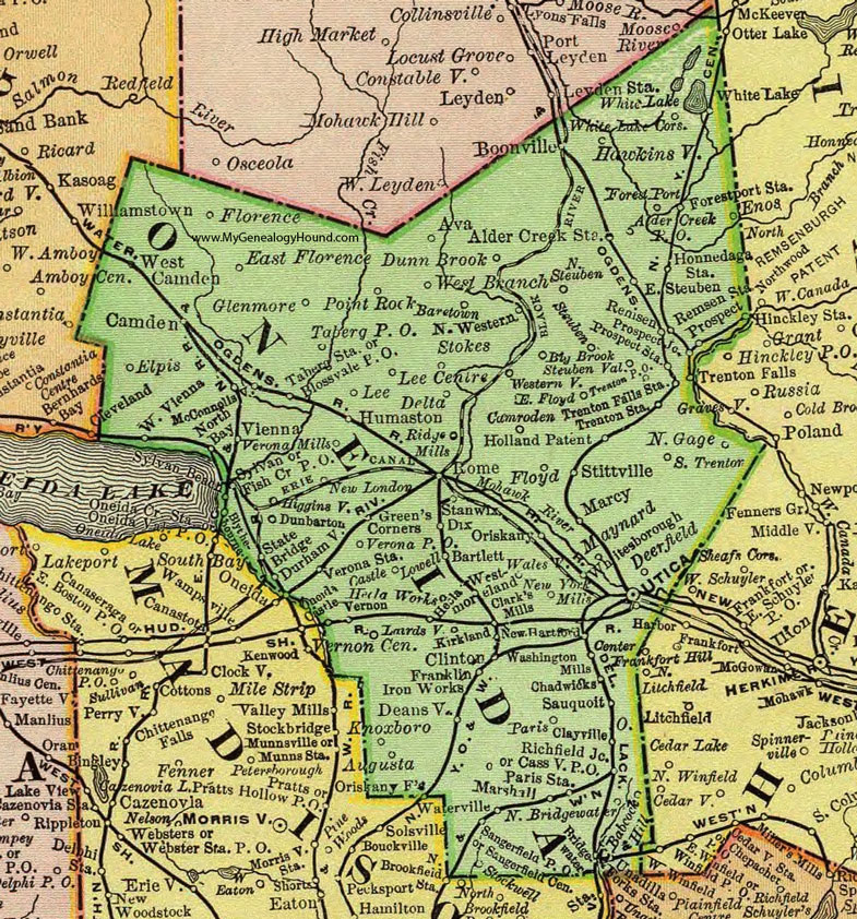
Oneida County, New York 1897 Map

Locations shown include: Alder Creek * Alder Creek Station * Augusta * Ava * Babcock Hill * Baretown * Bartlett * Big Brook * Blossvale P O * Boonville * Bridgewater * Camden * Camroden * Castle * Cassville P O * Chadwicks * Clark's Mills * Clayville * Clinton * Deansville * Deerfield * Delta * Dix * Dunbarton * Dunn Brook * Durhamville * East Florence * East Floyd * East Steuben * Elpis * Fish Creek P O * Florence * Floyd * Forestport * Forestport Station * Franklin Iron Works * Glenmore * Green's Corners * Hawkinsville * Hecla * Higginsville * Holland Patent * Honnedaga Station * Humaston * Kirkland * Knoxboro * Lairdsville * Lee * Lee Centre * Lowell * Marcy * Marshall * Maynard * McConnellsville * New Hartford * New London * New York Mills * North Bay * North Bridgewater * North Gage * North Steuben * North Western * Oneida Castle * Oriskany * Oriskany Falls * Paris * Paris Station * Point Rock * Prospect * Prospect Junction * Prospect Station * Remsen * Remsen Station * Richfield Junction * Ridge Mills * Rome * Sangerfield Centre * Sangerfield P O * Sauquoit * South Trenton * Stanwix * State Bridge * Steuben * Steuben Valley * Stittville * Stockwell * Stokes * Sylvan * Taberg P O * Taberg Station * Trenton Falls Station * Trenton P O * Trenton Station * Utica * Vernon * Vernon Center * Verona Mills * Verona P O * Verona Station * Vienna * Walesville * Washington Mills * Waterville * West Branch * West Camden * Westernville * Westmoreland * West Vienna * Whitesborough (Whitesboro) * White Lake * White Lake Corners *
This Oneida County map is a portion of an 1897 New York map by Rand McNally.
View additional New York Maps here: New York County Maps
County maps from other states can be viewed here: State County Maps
Use the links at the top right of this page to search or browse thousands of family biographies.