My Genealogy Hound
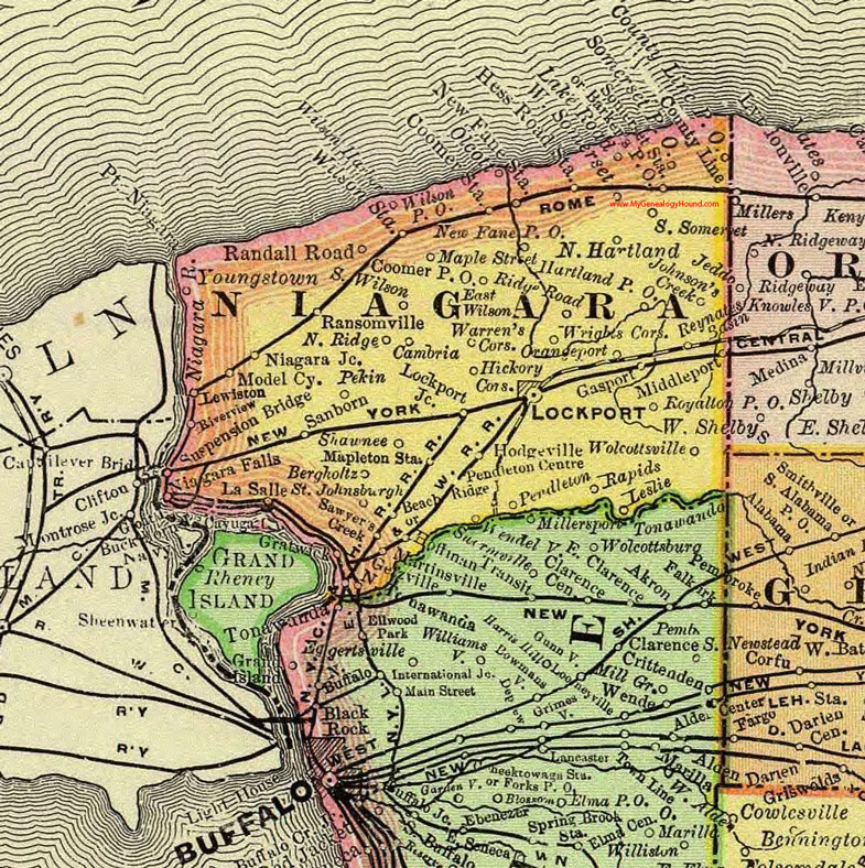
Niagara County, New York 1897 Map

Locations shown include: Barkers P O * Beach Ridge * Bergholtz * Cambria * Coomer P O * Coomer Station * County Line * County Line P O * East Wilson * Gasport * Hess Road Station * Hickory Corners * Hodgeville * Hoffman * Johnson's Creek * Lake Road * La Salle * Leslie * Lewiston * Lockport * Lockport Junction * Maple Street * Mapleton Station * Martinsville * Middleport * Model City * New Fane P O * New Fane Station * Niagara Falls * Niagara Junction * North Hartland * North Ridge * North Tonawanda * Olcott * Orangeport * Pekin * Pendleton * Pendleton Centre * Randall Road * Ransomville * Rapids * Reynates Basin * Ridge Road * Riverview * Royalton P O * Saint Johnsburgh * Sanborn * Sawyer's Creek * Shawnee * Somerset P O * Somerset Station * South Somerset * South Wilson * Suspension Bridge * Warren's Corners * Wendelville * West Somerset * Wilson Harbor * Wilson P O * Wilson Station * Wolcottsville * Wrights Corners * Youngstown *
This Niagara County map is a portion of an 1897 New York map by Rand McNally.
View additional New York Maps here: New York County Maps
County maps from other states can be viewed here: State County Maps
Use the links at the top right of this page to search or browse thousands of family biographies.