My Genealogy Hound
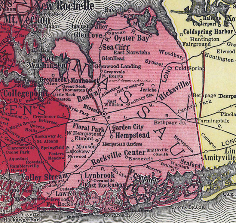
Nassau County, New York 1908 Map

Locations shown include: Albertson * Baldwin * Bayville * Bethpage * Bellmore * Bethpage Junction * Cedarhurst * Central Park * Cold Spring * East Norwich * East Williston * East Rockaway * Elmont * Farmingdale * Floral Park * Freeport * Garden City * Glen Cove * Glen Head * Glenwood Landing * Great Neck (Greatneck) * Greenvale * Hempstead * Hempstead Gardens * Hewlett * Hicksville * Inwood * Jekyl Island * Jericho * Lake View * Lawrence * Locust Valley * Long Beach * Lynbrook * Manhasset * Massapequa * Merrick * Millneck * Mineola * Munson * Nassau * New Hyde Park * North Roslyn * Norwood * Oceanside * Old Westbury * Oyster Bay * Port Washington * Rockville Center * Roosevelt * Roslyn * Sea Cliff * Seaford * Seawanhaka * Smithville South * Syosset * Thomaston P O * Totten * Valley Stream * Wantagh * Westbury Station * West Hempstead * Woodbury * Woodmere *
This Nassau County map is a portion of an 1908 New York map by Rand McNally.
View additional New York Maps here: New York County Maps
County maps from other states can be viewed here: State County Maps
Use the links at the top right of this page to search or browse thousands of family biographies.