My Genealogy Hound
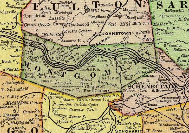
Montgomery County, New York 1897 Map

Locations shown include: Akin * Ames * Amsterdam * Argusville * Auriesville * Blaine * Buel * Burtonsville * Canajoharie * Charleston * Charleston Four Corners * Cranesville * Downing * Flat Creek * Fonda * Fort Hunter * Fort Plain * Frey's Bush * Fultonville * Glen * Hallsville * Kline * Marshville * Mill Point * Minaville * Minden * Mindenville * Paltine Bridge * Randall P O * Rockton * Rural Grove * Saint Johnsville * Scotch Bush * Sprakers * Sprout Brook * Stone Arabia * Tribes Hill * Yosts *
This Montgomery County map is a portion of an 1897 New York map by Rand McNally.
View additional New York Maps here: New York County Maps
County maps from other states can be viewed here: State County Maps
Use the links at the top right of this page to search or browse thousands of family biographies.