My Genealogy Hound
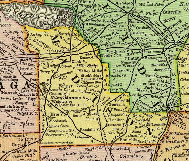
Madison County, New York 1897 Map

Locations shown include: Bingley * Bouckville * Brookfield * Canaseraga * Canastota * Cazenovia * Cazenovia Station * Chittenango Falls * Chittenango P O * Chittenango Station * Clockville * Cottons * Delphi Station * De Ruyter * East Boston P O * East Hamilton * Eaton * Erieville * Fenner * Georgetown P O * Georgetown Station * Hamilton * Hubbardsville * Kenwood * Lakeport * Lake View * Lebanon * Leonardsville * Mile Strip * Morrisville * Morrisville Station * Munnsville * Munnsville Station * New Woodstock * North Brookfield * North Brookfield Station * Oneida * Oneida Crossing Station * Oneida Valley P O * Pecksport * Perryville * Petersborough * Pine Woods * Poolville * Pratts * Pratts Hollow P O * Randallsville * Rippleton * Sheds Corners * Shorts * Solsville * South Bay * South Brookfield * South Hamilton * Stockbridge * Sullivan * Valley Mills * Wampsville * West Eaton *
This Madison County map is a portion of an 1897 New York map by Rand McNally.
View additional New York Maps here: New York County Maps
County maps from other states can be viewed here: State County Maps
Use the links at the top right of this page to search or browse thousands of family biographies.