My Genealogy Hound
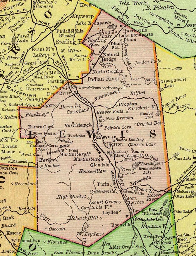
Lewis County, New York 1897 Map

Locations shown include: Barnes Corners * Beaver Falls * Belfort * Bellwood * Boyd * Brantingham * Bushes Landing * Castorland * Chase's Lake * Collinsville * Constableville * Copenhagen * Croghan * Crystal Dale * Deer River * Denmark * Diana * Diana Station * East Martinsburgh P O * Gardner's Corners * Glendale * Greig * Harrisburgh * Harrisville * High Market * Hooker * Houseville * Indian River * Jerden Falls * Kirschnerville * Lake Bonaparte * Lanesburg * Leyden * Leyden Station * Locust Grove * Lowville * Lyonsdale * Lyons Falls * Martinsburgh (Martinsburg) * Martinsburgh Station * Mohawk Hill * Monique * Montague * Natural Bridge * Naumburgh * New Boston * New Bremen * North Croghan * Number Four * Osceola * Parker's * Petrie's Corners * Pinckney * Port Leyden * Rector * Sterling Bush * Turin * Watson * West Leyden * West Martinsburgh * Windecker *
This Lewis County map is a portion of an 1897 New York map by Rand McNally.
View additional New York Maps here: New York County Maps
County maps from other states can be viewed here: State County Maps
Use the links at the top right of this page to search or browse thousands of family biographies.