My Genealogy Hound
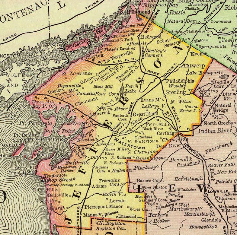
Jefferson County, New York 1897 Map

Locations shown include: Adams * Adams Center * Alexandria Bay * Alversons * Antwerp * Belleville * Bentley's Corners * Bishop Street * Black River * Brownville * Burrs Mills * Carthage * Champion * Chaumont * Clayton * Depauville * Dexter * Diamond * Dillin * East Houndsville * East Rodman * East Watertown * Ellisburgh * Evans Mills * Felt's Mills * Grand View * Great Bend * Fisher's Landing * Grenoll * Grindstone * Henderson * Henderson Harbor * Keenes * LeRaysville * Limerick * Lorrain * Mannsville * Natural Bridge P O * North Wilna * Omar * Orleans Corners * Orleans Four Corners P O * Oxbow * Pamelia * Philadelphia * Pierrepont Manor * Plessis * Pamelia Four Corners * Perch River * Pillar Point * Point Vivian * Redwood * Rices * Rosiere * Rural Hill * Rutland * Sacket's Harbor * Saint. Lawrence * Sanfords Corners * Smithville * South Champion * South Rutland * Sterlingville * Stone Mill * Theresa Junction * Theresa P O * Thousand Island Park * Three Mile Bay P O * Three Mile Bay Station * Tremaine Corners * Watertown * Watertown Junction * Westminster Park * Winona * Woods * Woodville * Worth Center * Worthville *
This Jefferson County map is a portion of an 1897 New York map by Rand McNally.
View additional New York Maps here: New York County Maps
County maps from other states can be viewed here: State County Maps
Use the links at the top right of this page to search or browse thousands of family biographies.